

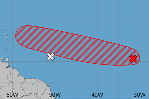
The T&T Met Service says a Tropical Wave about 1,300 kilometres east of the Windward Islands is no longer expected to develop into a tropical cyclone.
The system now has a zero percent chance of development over the next seven days, as Saharan dust continues to limit thunderstorm activity.
However, the Met Service says it will continue to monitor the wave as it moves westward.
There are currently no watches or warnings in effect for T&T.
Meanwhile, the National Hurricane Centre is continuing to monitor a disturbance further east, which now has a 70% chance of cyclone formation in seven days.
It says shower and thunderstorm activity is currently limited in association with an area of low pressure located about 500 miles southwest of the Cabo Verde Islands.
Environmental conditions are forecast to become more conducive for development during the next couple of days, with a tropical depression likely to form in the latter half of this week.
This system is currently moving west to west northwest across the central tropical Atlantic.
It poses no direct threat to T&T.