

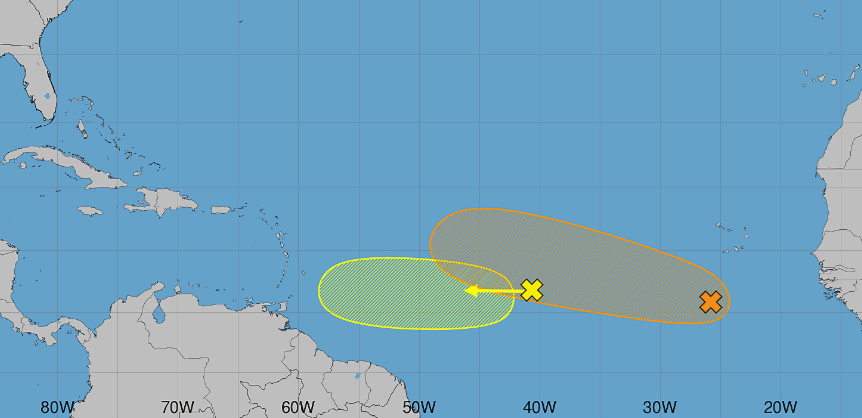
The National Hurricane Centre is tracking two disturbances in the Atlantic.
One is a broad area of showers and thunderstorms located about midway between the coast of West Africa and the Lesser Antilles.
The NHC says some gradual development is possible through mid-week as it moves westward through the central tropical Atlantic.
However, upper level winds are expected to become less favourable for development later in the week as the system approaches the Lesser Antilles.
Meanwhile, further to the east, there is an area of low pressure located a few hundred miles south of the Cabo Verde islands.
As it moves westward, it is expected to merge with a tropical wave currently over West Africa.
A tropical depression could form later this week, as conditions are expected to become more conducive for development.