
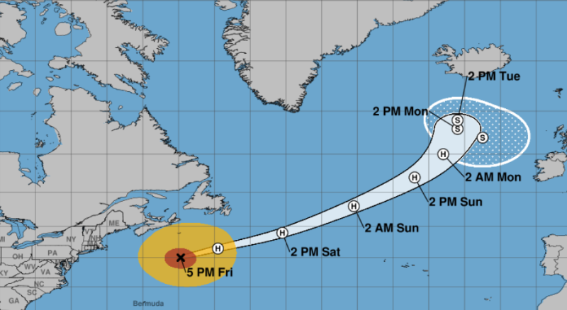
Erin is now a post tropical cyclone.
According to the National Hurricane Centre, it is expected to pass south of Atlantic Canada today and tonight, and then race across the north Atlantic.
Maximum sustained winds remain near 150 km/h, with Erin likely to remain a large and powerful hurricane-force low pressure system through the weekend.
Also, while there are currently no coastal watches or warnings in place, this system is still expected to affect some areas:
WIND: Gale-force wind gusts are possible along portions of the coast of Nova Scotia today and the Avalon Peninsula of Newfoundland on Saturday.
SURF: Swells generated by Erin will affect the Bahamas, Bermuda, the east coast of the United States, and Atlantic Canada during the next few days. These rough ocean conditions are expected to cause life-threatening surf and rip currents.
STORM SURGE: Some coastal flooding is expected at times of high tide along portions of the U.S. Mid-Atlantic and New England coasts through tonight, making some roads impassable.