
Hurricane Erin is now a Category 5 system.
However, it poses no threat to Trinidad and Tobago.
According to the National Hurricane Centre, maximum sustained winds are near 260 km/h with higher gusts.
Some strengthening is possible this afternoon, with fluctuations in intensity expected for the rest of the weekend.
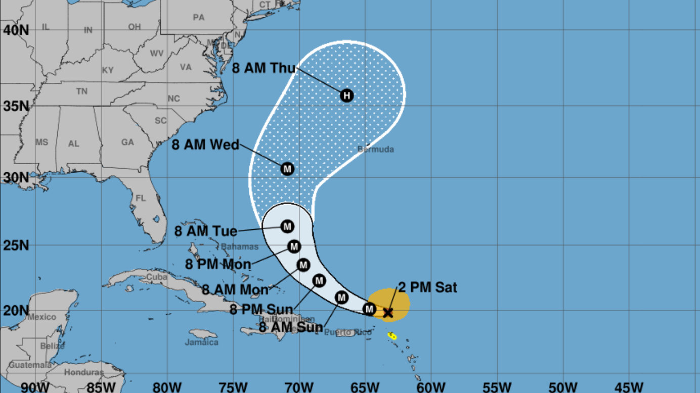
Hurricane Erin is moving toward the west near 26 km/h.
This motion is expected to continue this afternoon, with a turn toward the west-northwest expected tonight and a turn toward the north expected to occur early next week.
On the forecast track, the center of Erin is expected to move just north of the northern Leeward Islands, the Virgin Islands, and Puerto Rico through Sunday.
A Tropical Storm Watch is in effect for:
- St. Martin and St. Barthelemy
- Sint Maarten
Interests elsewhere in the northern Leeward Islands, Virgin Islands, and Puerto Rico, as well as in the Turks and Caicos and the southeastern Bahamas are advised to monitor Erin’s progress.
The outer bands of Erin are expected to continue producing areas of heavy rainfall through Sunday across the northern Leeward Islands, the Virgin Islands, and Puerto Rico.
Rainfall totals of 2 to 4 inches, with isolated totals of 6 inches, are expected.
Locally considerable flash and urban flooding, along with landslides or mudslides, are possible.