
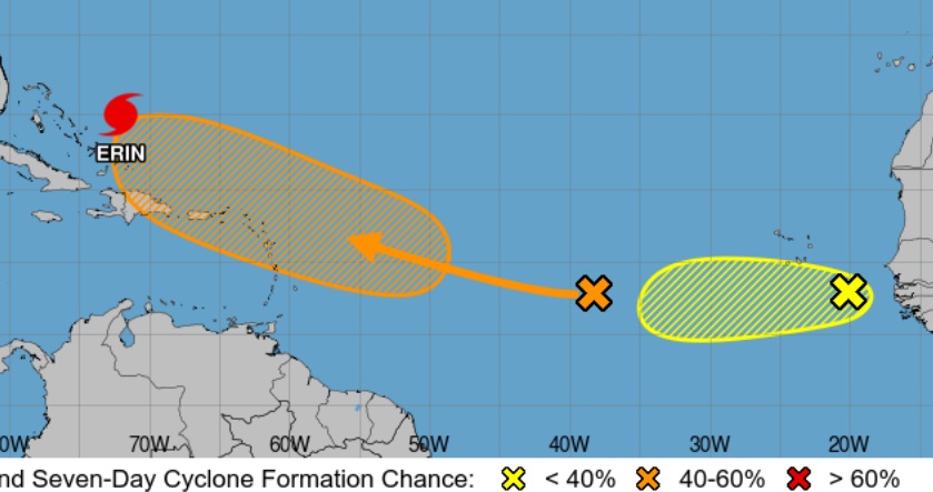
A weather system in the mid-Atlantic now has a 60 per cent chance of development within the next week, as it approaches the Caribbean.
The Hurricane Centre in Miami’s forecast track for this system shows it possibly passing over the northern Leeward Islands, as it moves west north-west.
A tropical depression could form towards the end of the week, or weekend. The projected path shows no threat for Trinidad and Tobago at this time.
Meanwhile, a second weather disturbance behind this one, which is currently closer to Africa right now, has a lower chance of development, as it moves across the Atlantic.
Meanwhile Hurricane Erin is bringing storm surges to Turks and Caicos and the Bahamas today, as it moves over the western Atlantic between the U.S. east coast and Bermuda on Wednesday and Thursday.
Erin is a category 3 hurricane and fluctuations in strength are possible over the next few days.
At this time, a Tropical Storm Warning is in effect for the Turks and Caicos Islands and Southeast Bahamas and a Tropical Storm Watch is in effect for Central Bahamas to Beaufort Inlet to Duck, North Carolina.