
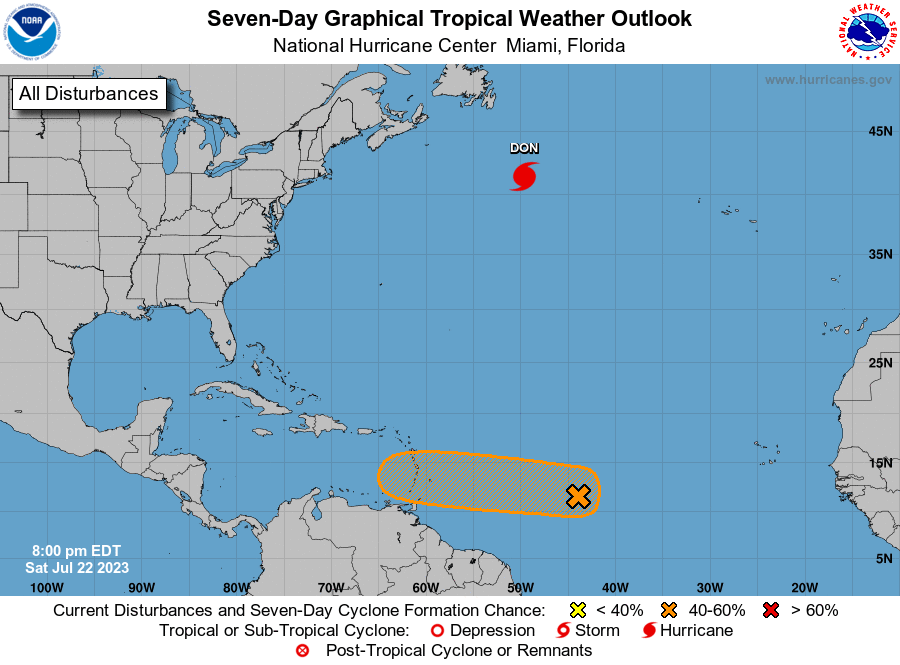
The Trinidad and Tobago Meteorological Service is monitoring an area of low pressure near the central Tropical Atlantic, east of the Southern Windward islands.
At 2:00 pm on Saturday, the relatively small area of active weather, associated with the low, was near 43 W longitude (Approximately 1800 km east of the southern Windward islands). The low has become a little less organized since Friday, but continues to produce disorganised showers and thunderstorms.
The National Hurricane Center has given the system a 40% chance of developing into a Tropical Cyclone over the next 48 hours and a 60 % chance of development through 7 days. Environmental conditions are forecast to be marginally conducive for gradual development, and the low pressure system could become a tropical depression early next week.
The initial outlook for Trinidad and Tobago is for cloudy periods with showers and the medium chance for thunderstorms over some areas, between Tuesday and Wednesday of next week.
THERE ARE CURRENTLY NO ALERTS, WATCHES OR WARNINGS IN EFFECT FOR TRINIDAD, TOBAGO, GRENADA AND ITS DEPENDENCIES.
Responses