
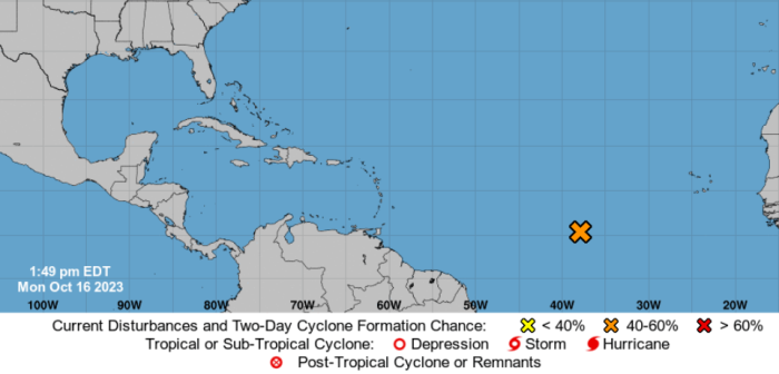
The Met Service is monitoring an area of low pressure to the east of T&T.
This broad low pressure area is producing disorganized showers and isolated thunderstorm activity.
The National Hurricane Center says environmental conditions are expected to remain conducive for further development, with a tropical depression likely to form within a few days.
It has given the system a 40% chance of developing into a Tropical Cyclone over the next 48 hours and an 80% chance of development through 7 days.
The initial outlook is for the system to pass north of T&T as it approaches islands in the eastern Caribbean.
The TTMS emphasizes that at this time, there are no alerts, watches or warnings in effect for T&T.
Responses