
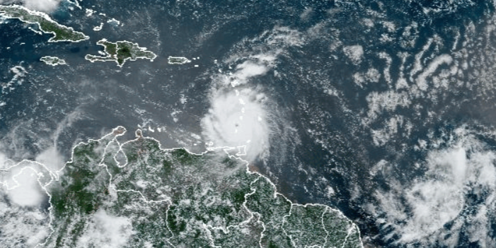
As Hurricane Beryl moves westward away from T&T, the Met Service has discontinued Trinidad’s Tropical Storm Warning and put in place an Adverse Weather Alert – Orange Level.
This runs until 6pm today.
The alert states, “The Tropical Storm Warning for Trinidad has been discontinued, and an Orange Level Adverse Weather Alert is now in effect. While the threat of tropical storm conditions, including sustained winds of 63-118 km/h, has diminished as Hurricane Beryl moves westward away from Trinidad, there remains a high chance (70%) of periods of rainfall of varying intensities with isolated thunderstorms. Gusty winds near 55 km/h may accompany heavier downpours. Street flooding is likely during heavier rainfall and landslides/landslips are probable in areas so prone. Large battering waves have been observed and hazardous seas are expected to persist, posing a danger to small craft, coastal and offshore activities. Mariners should continue to expect significant wave heights, posing a danger to small craft, coastal and offshore activities. At this time, all major river courses remain contained.”
Meanwhile, it has downgraded the Hurricane Warning for Tobago to a Tropical Storm Warning – Orange Level which runs until 3pm today.
The warning states, “The Hurricane Warning for Tobago has been downgraded to a Tropical Storm Warning. At 11 am, Hurricane Beryl was located at 12.4N latitude, 61.3 W longitude. The potential for hurricane force winds has decreased significantly as Hurricane Beryl moves away from the island. The possibility of impacts from tropical storm force winds still exists. Periods of showers and extended periods of rain are expected. Gusty winds are expected in heavy showers and thunderstorms that can still occur. The likelihood of landslides remains in areas so prone. Hazardous seas have been observed with large, battering waves and mariners should continue to expect significant wave heights, posing danger to small craft, coastal and offshore activities. Strong currents and choppy seas will make navigation hazardous.”
Officials are urging caution as soil remains saturated with the chance for landslips and flooding in prone areas.
Local Government Minister Faris Al Rawi noted that river levels as at 7am were as follows: Arouca 42.5%, South Oropouche 13%, El Carmen 26%, Caroni/Tumpuna 40% and North Oropouche 10%.
He noted that these levels are expected to rise as high tide comes around 1:40pm and there is expected bad weather in keeping with the adverse weather alert.
Responses