
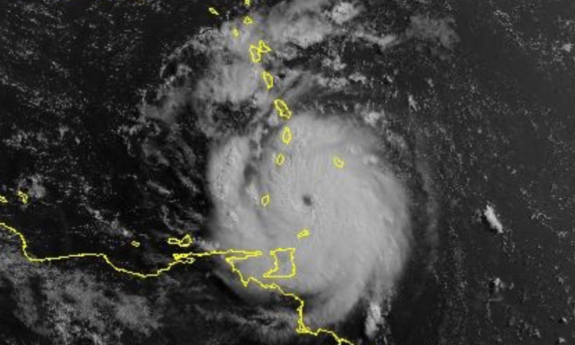
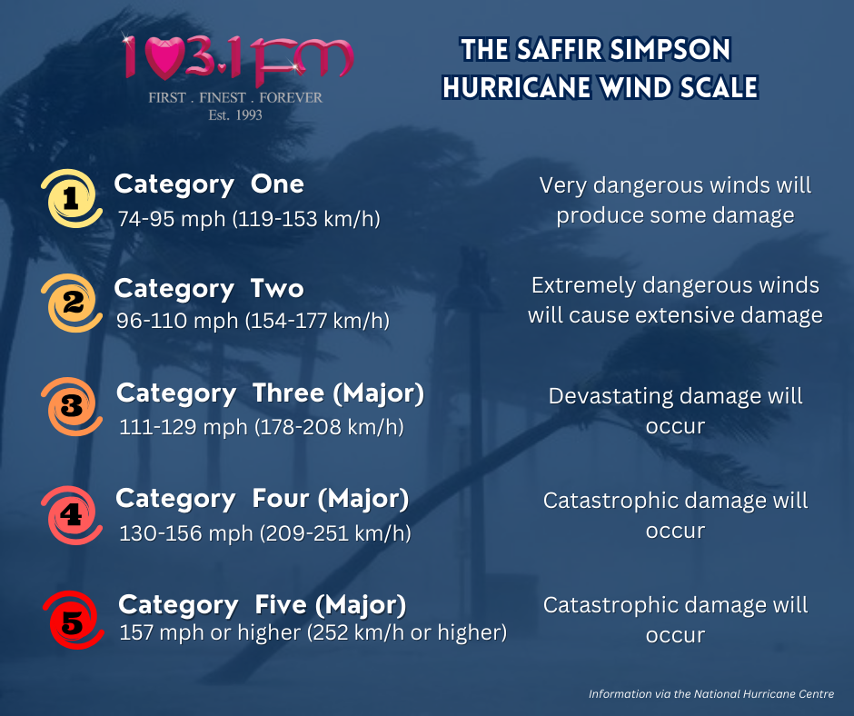
Beryl has once again strengthened to a Category 4 hurricane.
At 8am, the National Hurricane Centre issued an update saying data from the NOAA and Air Force Hurricane Hunters indicate that maximum sustained winds have increased to near 130 mph (215 km/h) with higher gusts.
Beryl is expected to move across the Windward Islands this morning and across the southeastern and central Caribbean Sea late today through Wednesday.
Fluctuations in strength are likely during the next day or so, but Beryl is expected to remain an extremely dangerous major hurricane as its core moves through the Windward Islands into the eastern Caribbean.
Some weakening is expected in the central Caribbean by midweek, though Beryl is forecast to remain a hurricane.
The Grantley Adams International Airport on Barbados recently reported sustained winds of 47 mph (76 km/h) with a gust to 69 mph (111 km/h).
TRINIDAD & TOBAGO
A Hurricane Warning RED LEVEL remains in effect for Tobago, meaning there is a higher potential for hurricane conditions, in this case within the next 4 hours.
The TTMS says periods of showers and gusty winds have been observed and are expected to continue.
The likelihood of landslides will increase as the morning progresses.
Hazardous seas have been observed with large, battering waves and mariners are being warned to expect significant wave heights, posing danger to small craft, coastal and offshore activities.
Strong currents and choppy seas will also make navigation hazardous.
Trinidad is presently under a Tropical Storm Warning.
This means there is a high potential for tropical storm conditions within the warning area over the next 4 hours.
Hazardous seas with large, battering waves have also been confirmed.
Showers and/or thunderstorms can be accompanied by wind gusts exceeding 55 km/h associated with Beryl’s outer bands.
Landslides/landslips are also likely in areas so prone.
Responses