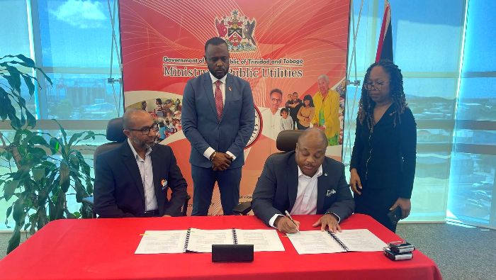
By March next year, the T&T Met Service should have access to a GOES 16 Satellite Receiving Ground-Station.
Yesterday, a contract was signed between the Public Utilities Ministry and Enterprise Electronic Corporation for acquisition of the equipment.
The (GOES) 16, now known as GOES-East, is a geostationary satellite designed to monitor and provide a range of data and information related to weather and environmental conditions.
TTMS Director Shakeer Baig says the satellite will play a pivotal role in enhancing the organization’s understanding of the Earth’s atmosphere, monitoring severe weather events, and providing critical data for weather forecasting, climate research, and disaster management.
He also expects it to greatly improve the Met Service’s ability to monitor and respond to environmental and weather-related challenges.
Mr Baig told 103.1FM News that there should be complete installation of the new system and full operations before the end of March 2024.
Some of its key capabilities include:
- High-Resolution Imaging: GOES 16 is equipped with advanced instruments capable of capturing high-resolution images of Earth. It provides imagery in visible, infrared, and water vapor channels, allowing meteorologists to monitor cloud cover, storm systems, and atmospheric conditions with exceptional detail.
- Rapid Scan and Mesoscale Coverage: The satellite can perform rapid scans and focus on specific areas of interest in a much higher temporal resolution than its predecessors. This is particularly valuable for monitoring severe weather events, such as thunderstorms, hurricanes, and tornadoes, in near real-time.
- Lightning Detection: GOES 16 has a specialized instrument for the detection of cloud-to-ground lightning strikes. This capability is crucial for tracking the development and intensity of thunderstorms and can aid in early warning systems.
- Space Weather Monitoring: The satellite can observe and monitor solar activity, including solar flares and coronal mass ejections. This helps in predicting and understanding space weather events that can impact satellite communications, GPS systems, and power grids on Earth.
- Improved Hurricane Tracking: With its advanced imaging capabilities, GOES 16 provides more accurate and timely information for tracking hurricanes and tropical storms. This is essential for issuing forecasts and warnings to protect coastal communities.
- Fire Detection: The satellite can detect and monitor wildfires in real-time. This is crucial for early fire detection, tracking fire spread, and aiding in disaster response efforts.
- Atmospheric Soundings: GOES 16 provides valuable vertical profiles of the Earth’s atmosphere, including temperature and moisture data. This is crucial for weather forecasting, especially for predicting severe weather events.
- Improved Data Transmission: The satellite can relay data more quickly and efficiently to ground stations, enabling meteorologists to access real-time information and make timely decisions for weather forecasting and disaster management.
- Long-Term Data Archive: GOES 16 contributes to a valuable archive of environmental data, allowing researchers and scientists to study and analyze long-term climate trends and changes.


Responses