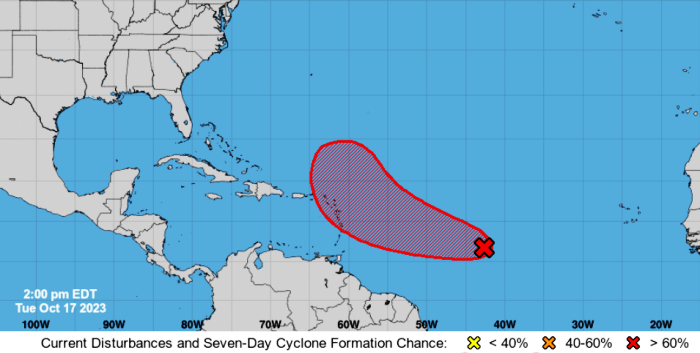
The Met Service continues to monitor an area of low pressure in the central Tropical Atlantic.
According to the National Hurricane Centre, the associated showers and thunderstorms are showing signs of organization.
Environmental conditions are expected to remain conducive for gradual development, with a tropical depression likely to form during the next day or two.
The NHC adds that regardless of development, this system has the potential to bring gusty winds, heavy rainfall and flooding to portions of the Lesser Antilles beginning Friday.
- Formation chance through 48 hours…high…70%
- Formation chance through 7 days…high…80%
With regard to T&T, the TTMS says the initial outlook is for the system to pass north of both islands as it approaches the eastern Caribbean.
It also emphasizes that there are currently no alerts, watches or warnings in effect for T&T.


Responses